Alaska Highway Redux

The Alaska Highway (also known as the ALCAN Highway) was constructed during World War II for the purpose of connecting the contiguous United States to Alaska across Canada.

IMG_2275.JPG
IMG_2284.JPG
IMG_1943.JPG
IMG_2279.JPG
IMG_2290.JPG

The last picture is the view from Muncho Lake campground. 

Currently at Fort Nelson which is Mile 300 on the Alaska Highway - continuing south to Mile 0 then on to Edmonton because perogies.

Kluane

Kluane National Park, along with Wrangell-St. Elias, Glacier Bay and Tatshenshini-Alsekaking make up the largest international protected area in the world - a UNESCO world heritage site since 1979.

IMG_2243.JPG

Kluane is home to the largest non-polar icefields in the world and contains 17 of Canada’s 20 tallest mountains including Mount Logan, the highest peak in Canada. There are bears (grizzly & black), Dall sheep, mountain goats, caribou and wolves. 

IMG_2224.JPG

When you visit, be sure to spend time in the Da Kų Cultural Centre - I spent an hour with an interpreter from Champagne Aishihik First Nations who outlined aspects of the culture and geography, impact of the neighboring ice fields, relationship to the coastal regions, and all sorts of information - there’s a giant map on the floor so we could move around as he explained the history. 💯

IMG_2135.JPG

The picture above is from the Da Kų Centre - the dugout canoe in the foreground isn’t made from the trees in the background - the route to the coast for trees like this is what is now the Haines Highway.

IMG_2185.JPG

This is my new favorite park, situated as it is near top of the Alaska Highway.

IMG_2237.JPG

The Saint Elias mountain range.

Haines Junction

The town of Haines Junction is at the intersection of the Alaska & Haines highways, and is a major administrative section for CFAN (Champagne and Aishihik First Nations). The original name of the area was "Dakwakada", a Southern Tutchone word meaning "high cache".

Below are a couple pictures of the Da Ku Cultural Center (and Kluane park office) and two little churches in town.

IMG_2140.JPG
IMG_2131.JPG
IMG_2145.JPG
IMG_2153.JPG
IMG_2165.JPG
IMG_2163.JPG

Rain, fog and cold for past 5 days and continuing for a couple more. Some zzzzz time.

Whitehorse

Here’s a picture of the rear tire I drove from Toronto, and the beefier tire installed for the Dempster - the first rode as a spare. For some reason 🏍’s are less succeptible than 🚗’s for flat tires (I saw 3 🚙’s plugging or replacing tires on the road). Advice is 2 inflated ready to go spares.

Dempster fun fact: there is CAA coverage on the road, unfortunately the whole way has no cell coverage, even in Eagle Plains (there are a few spots in the northern section). WiFi at Eagle Plains is $5.00 per day, and only works in the restaurant and bar, not in your room.

My turnaround point on the Dempster was about km 480 - 15 kms north of where the road crosses the NWT border; 70 kms south of Fort McPherson.

Word fact: Yukon is derived from dyukun-ah which means ‘great river’ in Gwich’in, the Athapaskan language of the region. The Yukon River was named by HBC trader John Bell in 1846.

The Yukon & NWT have been in a sunny heat wave for 25 days and now the weather has turned - the Top of the World Highway is under fog & rain for the next week and Chicken is socked in. Kluane beckons so south to Whitehorse and then to the park office at Haines Junction to get a hike figured out. Some pics of Whitehorse:

IMG_1967.JPG
IMG_1974.JPG
IMG_1972.JPG

The Dempster

A part of this trip was to drive the Dempster Highway to Tuktoyaktuk. The weather and resulting road conditions (and my driving skills) put a stop to that 2 or 3 hours north of the Arctic Circle. 

Pro tip: if planning to drive the Dempster, ignore everything anyone says. About anything. Go instead to the NWT tourism office in Dawson City and talk to staff there.  They know the score.

Motorcycles are strongly dissuaded from camping the route (which sux as there are excellent ⛺️ sites on way) due to the weight. I dropped off all of my gear (NWT tourism stored everything for me - they are 👍) and pared down to a minimum to make the bike as light as possible. Going motel to motel with bare essentials is the only way. 

The first 1/2 of the Dempster ends at Eagle Plains (there is no services until then). The surface is rough gravel and dirt (beware kms 250-350 as they use shale on the road) and relatively good.

IMG_2060.JPG
IMG_2067.JPG

Eagle Plains (aka Midway) is the only game in town. It’s the first set of services (376 km from the start) and has the motel, car wash, mechanic, tire install, and bar.

IMG_2076.JPG
IMG_0895.JPG

Day 2 itinerary: Eagle Plains to Innuvik (the second 1/2 of the Dempster). Then Innuvik to Tuktoyaktuk and back on day 3, and return on days 4/5. That’s the plan. Here’s leaving Eagle Plains:

IMG_2081.JPG

The Arctic Circle is about 36 kms north of Eagle Plains (woot!) and further on is Wright Pass which on this day was a cloud of rain with zero visibility (no 📷).

Further on conditions worsened (aka went to shit) as rain turned the road into long stretches of mud with the consistency of axle grease. 

IMG_2094.JPG

After slopping around for a few hours (and dumping the 🏍 twice) I found a place to turn around, took the promo shot at the Arctic Circle and returned to Midway.

IMG_2100.JPG

[Insert a long string of extremely offensive swear words]

Next up is return to gather up gear in Dawson City, then Top of the World Highway, Chicken USA and Kluane Park. 

Dawson City

The Town of the City of Dawson is on the Yukon River in the Yukon.

IMG_2029.JPG

Dawson was a base during the 19th-century Klondike Gold Rush; a fair number of the buildings are still standing. There are also some cool pubs, coffee shops and a big craft beers scene.

IMG_2035.JPG
IMG_2049.JPG
IMG_2044.JPG

Next turn is 40 kms east of Dawson City - gas up and head north on the Dempster Highway - it’s 365 kms to the next gas station at Eagle Plains.

Alaska Highway

The stretch of the Alaska Highway north of Fort Nelson is my new favorite road in Canada - aside from the odd critter:

IMG_1925.JPG

The road condition is essentially perfect.

IMG_1949.JPG

There is a stretch of 3 superb BC Provincial Parks along here - I stayed at 2 on the way north and hope to hit 3rd (Muncho Lake) on the way south.

Summit Lake P. P. campground ($20) has sites right by the lake:

IMG_1829.JPG

There is excellent hiking nearby with a couple trails leaving the camp site. 

IMG_1800.JPG

Further north is Liard Hotsprings P. P. ($26). A 10 minute walk from camp along a boardwalk is Canada’s second largest hot springs, which ends up meandering down a marshy river.

IMG_1918.JPG

Water is hottest to the right (upstream) going in. 

IMG_1902.JPG
IMG_1901.JPG

Further downriver the water cools off to about bath temperature and perhaps you have a waterproof case for your kindle with several hours to waste.

The hot springs are open year around (free in off season) and must be unreal on a winter night.

The entire stretch of Alaska Highway from Fort Nelson to Whitehorse is A+++

IMG_1854.JPG

Forts on the Road

Fort Smith is at the last portage on the water route north and is the only driving entrance to Wood Buffalo National Park.

IMG_1719.JPG

Fort Simpson is 689 kms west on Highway 5 and 1 (Mackenzie Highway). The town is on an island (ferry runs 6:00 to 24:00) at the juncture of the Liard and Mackenzie Rivers. It is the usual launching point for Nahanni park visits.

IMG_1763.JPG
IMG_1758.JPG
IMG_1749.JPG

Fort Liard is 286 km south on the Liard Highway, which is an indescribably shitty road. It’s a variety from chip-seal to loose gravel to rocks and dirt (when wet it’s a quagmire). Google’s estimate for this part of the journey is 9 hours and 59 minutes. 

IMG_1767.JPG

36 kms south of Fort Liard is the provincial border where one weeps with joy at the crisp line separating NWT chip-seal from beautiful BC asphalt. And 241 kms south of that is Fort Nelson which is in the Peace Valley at bottom of the Alaska Highway. 

Next step is north-west up the Alaska Highway towards Watson Lake then Whitehorse. 

Wood Buffalo

Wood Buffalo is the largest national park in Canada (44,807 km^2) - slightly larger than Switzerland. The park was established in 1922 to protect the world's largest herd of an estimated 5,000 free roaming wood bison.

IMG_1646.JPG

The only (drivable) access to the park is from Fort Smith which is 270 km east of the (last gas) Hay River. The entire way looks like:

IMG_1641.JPG

Fort Smith was founded on the Slave River where there are four sets of impassable rapids (Cassette Rapids, Pelican Rapids, Mountain Rapids, and Rapids of the Drowned). The portage around the 4 rapids (traditionally used by local aboriginal people for centuries) is the last on the way to the western Arctic which made Fort Smith an important trading hub.

The Oblate Catholic Mission had a large presence - 151 acres in the center of Fort Smith with various building as well as this grotto church:

IMG_1683.JPG

Pelican Rapids are so named as the Slave River here is a northern nesting spot for pelicans - who knew?

IMG_1666.JPG

Within the park is the remains of an ancient inland sea which evaporated 270 million years ago, leaving a huge (370 km^2) salt flat littered with boreal forest. 

IMG_1693.JPG

Westward. 

Prairies

Hours and hours and hours with a view like this: 

IMG_1603.JPG

If you don’t like the weather, drive another 10 minutes. I ❤️ this section of 🇨🇦.

West of Edmonton now at the juncture where highway #43 heads north from the Yellowhead highway (16W) towards Grande Prairie. 

Tuktoyaktuk

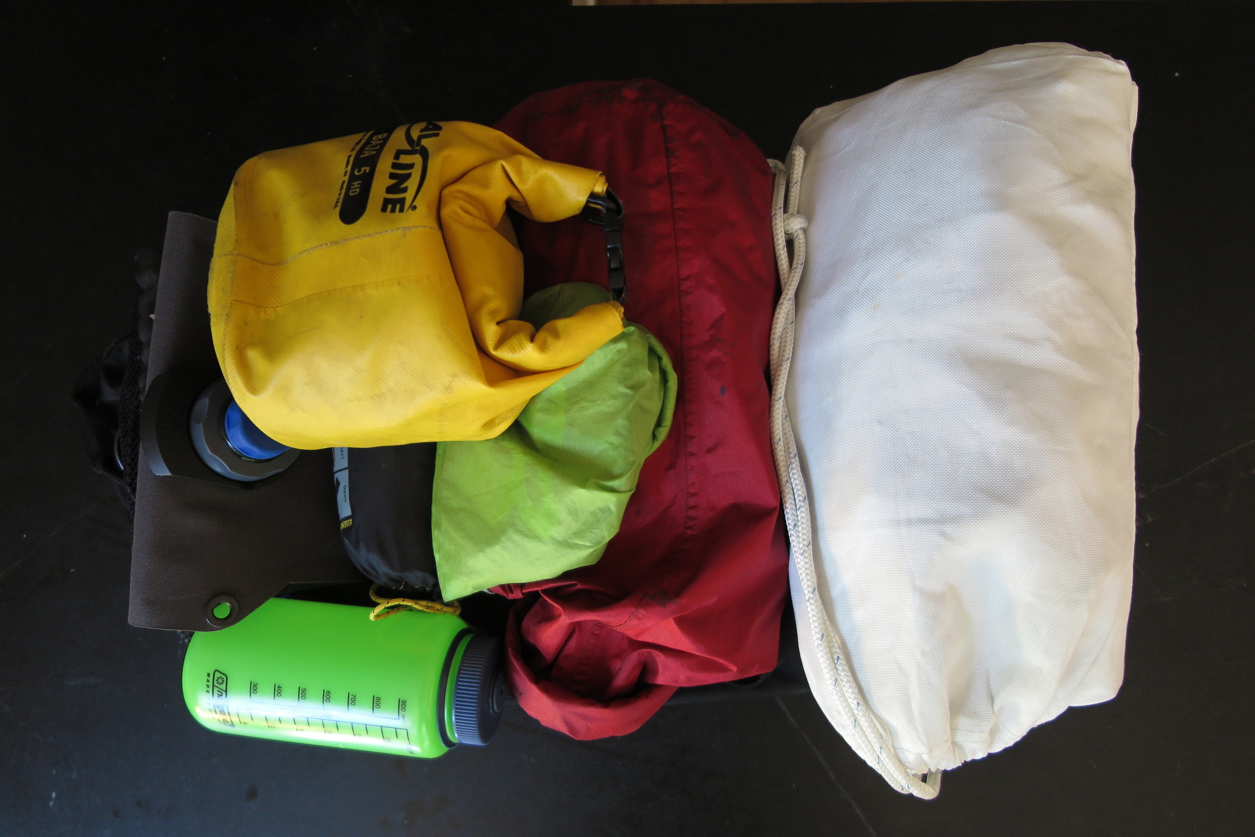
Big motorcycle trip in 2018 - heading off to Tuktoyaktuk now that the road is open from Innuvik - dip my toe in the Western Arctic ocean, with a side trip into Kluane National Park. Below is some information & photos on what I'm taking (and, more importantly, what I'm not).

tuk.jpg

Motorcycle Trip

Toronto / Tuktoyaktuk / Kluane National Park.

IMG_1524.JPG

Electronics

Battery pack to charge electronics (or jump-start a truck) with charger, kindle, iPhone, camera batteries & charger, sd card reader for phone, headphones, USB charging cables.

IMG_1516.JPG

Food

25 prepared meals with beef, chicken and/or shrimp with rice and assorted veggies, cured meats, aged gouda cheese, strawberries, bananas and other staples, milk powder, ghee, olive oil, balsamic vinegar, maple syrup flakes, salt, pepper, spices.

IMG_1533.JPG

Right Pannier

Fuel can and bottle, coleman and whisperlite stove, kitchen utensils, aeropress coffee maker in mug, bear spray, potset, fry pan, bowl and small mesh bag of ropes, straps, zipties, etc.

IMG_1530.JPG

Left Pannier

Contains a dry bag wiith first aid kit, gear repair stuff, and bear bangers. And the tent.

IMG_1540.JPG

Big Dry Bag

This massive dry bag contains a thermarest, sleeping bag, clothes, towel, personal gear, rubber boots, crocs, electronics bag, maps, etc..

IMG_1519.JPG

Mesh Bag

A mesh duffle goes on top of the big dry bag - this  contains jumper cables, tire repair kit, tire pressure gauge and inflator, nalgene bottle, water bag, camp chair, bear proof bag full o' food and dry bag with rest of food.

Mock Duck

Mock Duck was an underground band out of Vancouver with a few incarnations - the longest running lineup was Joe Mock (g), Glenn Hendrickson (d), Rick Enns (b) and Ross Barrett (sax). The name came from a spoonerism of 'fuck mock' in reference to the guitarist planning yet another rehearsal. Rick Enns was previously in Tom Northcott's band and the United Empire Loyalists.

Mock Duck's self-released 1968 Test Record is considered one of the rarest Canadian LPs ever made, as only 14 copies were originally pressed. The album is a collection of studio tracks (the single Do Re Mi had some local success) as well as live tracks recorded in 1968 including a 12 minute live improv. There's a strong element of jazz in their sound - the CD re-issue of Test Record also contains a 20 minute extended jam (Live Mock).

The single linked below is the fantastic Easterdog from 1968 - how this didn't dominate the charts at the time is a mystery:

Here is a link to a youtube video of Mock Duck playing Do Re Mi and Hurt On Me for the Cool Aid House Benefit concert.

Mother Tuckers Yellow Duck

Mother Tuckers Yellow Duck was started in 1967 in Vancouver as a collective: Kathy Kay (Mother Tucker), John Patrick Caldwell (The Yellow Duck aka Raphael Red The Village Idiot), Bob O'Connor (Dogan Pink Foot aka Sheldon O'Dogan), and Michael Goldman (Garnet Crystalman). At that time, O'Connor was the only musician - he left to join Medusa and the band proper formed around John Caldwell, adding Roger Law, Charles Falkner, High Lockheed and Donnie McDougall to become MTYD. Their first two singles were released on their own Duck Records label - the second single has the track One Ring Jane as the a-side:

The b-side is Kill The Pig which was recorded as a result of a run-in with the Vancouver police:

MTYD put out two albums - Home Grown Stuff in 1969 and Starting A New Day in 1970. They toured all over Canada and were active politically at rallies and protests; at some point they moved east from Vancouver to Toronto and Ottawa, but details are sketchy - this is one band crying out for a biography as the story would no doubt be fascinating.

Here is a link to a youtube video of MTYD playing for the Cool Aid House Benefit concert - they start with "I" (also their first single) and follow up with "Times Are Changing" which is the first track on Home Grown Stuff.

Cyber 170

In 1975, Control Data Canada sold a $1 million Cyber 170 system to Spain for use in agrarian research.

The Cyber 170 had one (or two) CPUs running at either 25 or 40 MHz and the memory operated in units of 60-bit words. A Control Data byte was 12 bits (same as the bit width of the peripherals), a character was 6 bits, the CPU instructions were either 15 or 30 bits. The memory addressing was 18 bits which results in a maximum of 256K words of addressable memory. The CPU was incapable of input or output and relied on Peripheral Processors to do any IO - the CDC170 could be configured with 10, 14, 17 or 20 of these processors.

In the photo is Irene Lazaro of the Spanish Tourism office, Layton Kinney (president of Control Data) and Harold Fishleigh, honorary vice-consul for Spain.

Photo courtesy of Toronto Public Library.

Witness Inc.

Witness, Inc was formed by Kenny Shields and some high school friends in Saskatoon 1967, gathering a reputation as a live act and releasing a number of singles such as Not You Girl:

In late 1969 Shields was in a serious car accident and required surgery and therapy - the band continued without him without much success. Kenny's recovery took until 1975  - he reformed Witness Inc. briefly but soon left to form Streetheart in 1976.

There is a nice CD release collecting up their singles.

Toronto Roadwork

The intersection of the Spadina (now Allen) Expressway and highway 401; photograph by Boris Spremo, taken in 1966.

Barbara Gryfe

Barbara Gryfe was 18 when she recorded this pop vocal album in 1969 for CBC records (LM 68). A regular performer for the CBC, Barbara had appeared on a number of tv shows and won the CBC Song Market in 1968 with ‘Colours Of The Rainbow’. On this album, she covers songs by Burt Bacharach and Jimmy Webb, as well as a couple of tracks from Fiddler on the Root. The orchestra was arranged and conducted by Rick Wilkins and it was recorded at Eastern Sound in May 1969.

The track linked below is Who Am I, written for Petula Clark by Tony Hatch and Jackie Trent. Upon hearing the song for the first time, Glenn Gould remarked that it was a "document of despair [which] catalogues [the] symptoms of disenchantment and ennui". Enjoy!

The CBC recordings were intended for distribution on vinyl to affiliate stations and were limited to only 250 copies, making the albums extremely rare collectors items. The vaults are being opened through the MajikBus transcription series which is releasing vinyl re-issues and other treasures. The full list of CBC recordings is on discogs.

Food Planning 1971

If you think it's tough stretching your dollar these days...

Perth County Conspiracy

The Perth County Conspiracy is forever associated with the Black Swan Coffee House in Stratford ON where the band would play shows following performances at the nearby Shakespeare Festival, often playing to 4:00 AM. The two main co-conspirators were Cedric Smith and Richard Keelan along with a roving cast of musicians, friends and family members.

Richard Keelan was part of the Detroit scene in the mid-60s - he was a member of the Spike Drivers and The Misty Wizards (both with Ted Lucas) before coming up to Canada. The Spike Drivers and Misty Wizards put out some fantastic stuff - for example It's Love by the latter:

Richard Keelan moved to Canada and settled near Stratford and met Cedric Smith, a poet, folk singer and actor (he won a Gemini award in 1993 for his work on Road to Avonlea).

In 1969 they named themselves the Perth County Conspiracy. In 1970 they recorded their first album (Does Not Exist) for Columbia. They were also invited to record an album in the CBC studios; their self-titled LP which immediately followed their first. They then put out a double live album (Alive) on Columbia and recorded several more (live) albums under their own label.

This episode of Inside The Music from CBC radio in 2011 discusses the PCC's first album (Does Not Exist) and also delves into the counter-culture and the surrounding community of musicians, poets, friends and family.

The second (self-titled) album was recorded on the CBC label as promotion to the affiliate stations across Canada, so only 250 copies were originally pressed - this LP has now been re-issued as part of the CBC music transcription series. From this album, this is If You Can Want:

Here's a youtube link to the Spike Driver's playing Strange Mysterious Sounds on the tv show Swingin' Time from 1967, and finally, the cover of the Spike Driver's single Baby Won't You Let Me Tell You How I Lost My Mind.

the-spike-drivers-baby-wont-you-let-me-tell-you-how-i-lost-my-mind-reprise-5.jpg

Now go give It's Love another listen. Yea.

Kensington Market

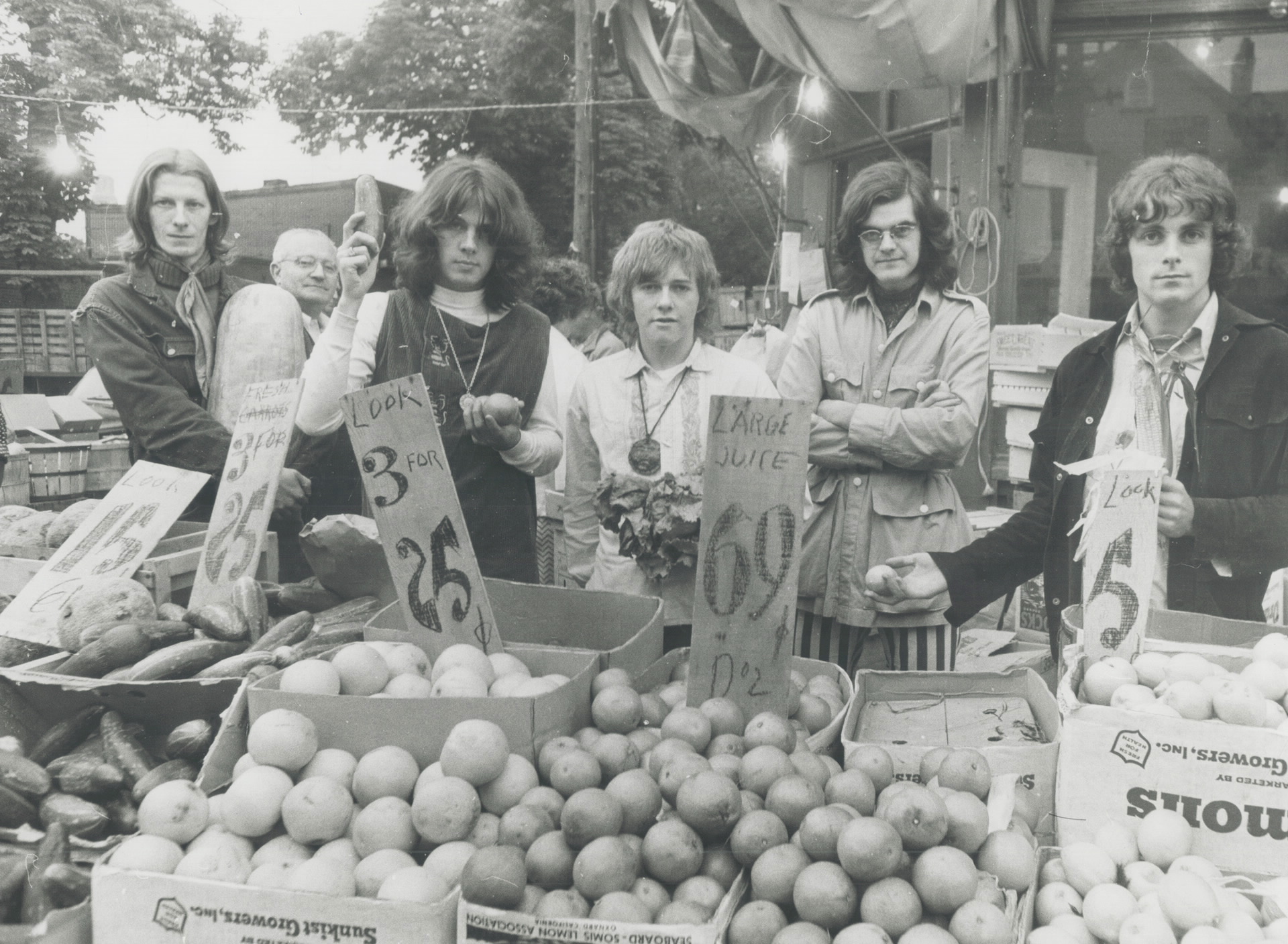
The band Kensington Market at the market - left to right is Alex Darou, Keith McKie, Jimmy Watson, Gene Martynec (who appears disinclined to pose with vegetables) and Luke Gibson.

kensington-market-1.jpg

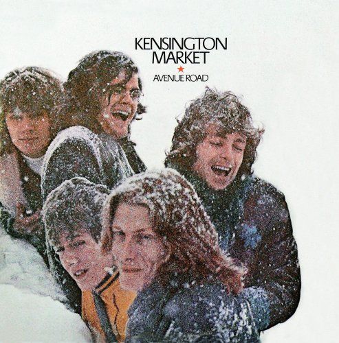
In 1968 Kensington Market did the soundtrack for the NFB film 'The Ernie Game' and later that year Felix Pappalardi produced their first album  'Avenue Road' (which non-Torontonians found to be a strange album name). Here is the lead off track 'I Would Be The One':

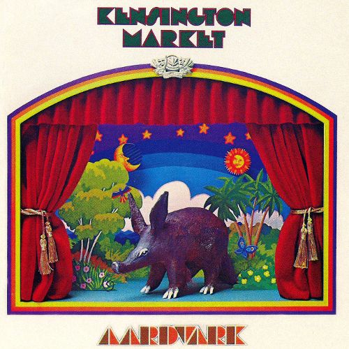
In 1969 John Mills-Cockell was added on keyboards - this is 'Help Me' from the second album 'Aardvark':

The album covers from the two Kensington Market albums.